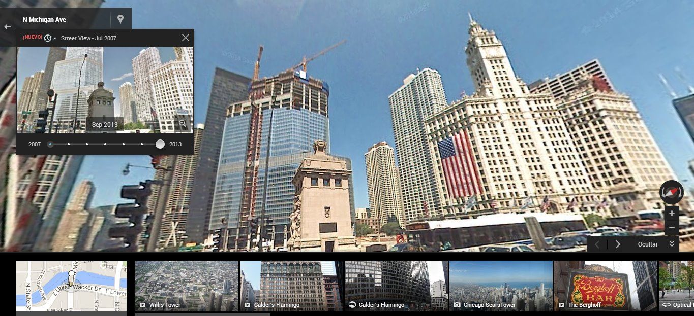
A few days ago a new feature came to Google Maps, integrated into Street View, which allows you to view streets exactly as they were several years ago. With seven years under its belt since the service was launched, this Time Machine is a historic and huge tool. Here we explain how it works.

At the moment, this tool is only available in the web version of Google Maps. Once you go in on StreetView to the street that you want, you’ll see a new icon in the upper left part of the screen below the address of the location you’ve pinpointed. Dropping down the menu, you’ll find a slidable bar to set the time period that you want to view. The number of points of reference will vary from one place to another, since it will depend on the times that the Google cam car has passed through the area.
With this tool you can view everything from daily progress on buildings construction or other street works, to how rural areas look during different seasons of the year. Not to mention much more significant events like the destruction of entire areas after natural disasters such as the 2011 Japanese earthquake.